FKT Report: "Rider on the Camel in the Storm" The Bamforth Ridge by Ben Nephew
Sometimes the key is just showing up, and that can be a challenge at times. Two weeks ago I was hoping to get up to Vermont to run some miles on the Long Trail, with the plan being a 21 mile out and back FKT (fastest known time) attempt on the Monroe Skyline from Appalachian Gap to Lincoln Gap. I like to use FKT’s as key threshold workouts, especially in the off season. While it can seem hard to compare efforts between runs, once you do a few similar routes you can get a good idea of the quality of your runs, especially on routes that have a number of attempts on Strava where you can also compare with other runners. The grade adjusted pace in Strava on climbs makes these comparisons easier. I have a few threshold routes around Westborough, but they are quite flat and not as entertaining as some of the FKT’s in more mountainous areas. I only had time to get out on Sunday morning, and the weather was looking a bit unsettled with some sort of rain/snow/blizzard combo. It seemed that there was going to be a window of decent weather from 8-12; maybe it was my imagination. I got up around 3 with the hopes of hitting the trail around 7.
Things got interesting as soon as I left route 89 to make my way to Lincoln Gap. Apparently, there is a route 12, as well as a 12A, and they take you to different parts of the state. After a few scenic miles on 12, I made my way over to 12A. This included crossing a low ridge behind two trucks which I just about slid into as the rain changed to snow. My worn all season tires were not helping. As I thought about the Lincoln Gap Road, which is not plowed in winter and a thousand feet higher, I decided to start on the other end of the ridge at Mad River Glen. This plan was working well until about a mile south of the ski area, where the snow started to come down hard. As soon as I got around the corner from Mad River, my car slowly started to slide off the road, going uphill. Again, this road is not plowed in the winter, and getting stuck up at the trailhead or sliding off the road trying to come back down, no thanks. I possibly could have parked at Mad River, but I was running out of time to complete the FKT route. Plan C was to head north to ride the Camel’s Hump by the Bamforth Ridge, where the trailhead was about 2k feet lower. It was raining hard as I drove north, and I was starting to accept that I might be out for a 7 hour ride with no run.
The rain settled down by the time I reached the trailhead, and it was good to get out of the car and move around. I threw my Inov-8's Arctic Talons on, a light shell, and that was it for preparation. The route involved 6 miles with 4k of climb to the summit, then back down along the same ridge. I had heard great things about the Bamforth Ridge, and have wanted to get up there for quite a while. The first mile was runnable, but quite wet, and then things got white once I passed an elevation of 1k. The snow was not too deep for the second mile, but it was clearly getting deeper as I climbed. With the snow sticking to the trees, and the white trail markers, I was very appreciative for a lone set of tracks of a runner somewhere up ahead. My lead runner was wearing Inov-8’s as well. The studs on my Talons were definitely helpful on the snow covered rocks and roots.

Inov-8 Artic Talons
As the wind started to pick up, the prints would get blasted clean on exposed sections of the ridge, hinting at challenges to come. There were 3-4 inches of snow past 3 miles, which had rapidly accumulated. I was thinking how lucky I was to have tracks to follow at around 4 miles when I saw my lead man running back towards me. We exchanged a quick greeting, and I began to worry about how long his track would last over the last two miles. There was no need to worry, as he had turned back a little ways up the trail on a granite outcrop; I was on my own. Finding the trail on the other side took some searching, and I wondered if that was my cue to head back down. I probably would have turned back if I wasn’t wearing spiked shoes, and I decided to keep going as long as I still seemed to be on some sort of path. There were some wild rock scrambles over the fifth mile, some of which may not have been on the trail.
I was getting wet from a combination of sweat, driving snow, pushing through snowy foliage, and running through arctic slush puddles. At one point, my hands became soaked when I had to lower myself down into a rift between two boulder faces covered in flowing water. The increased cold kept me motivated to get to the summit, and down, as quickly as possible, whether or not there was a FKT involved. The last mile to the summit was easier to follow, partly due to the steep grade.
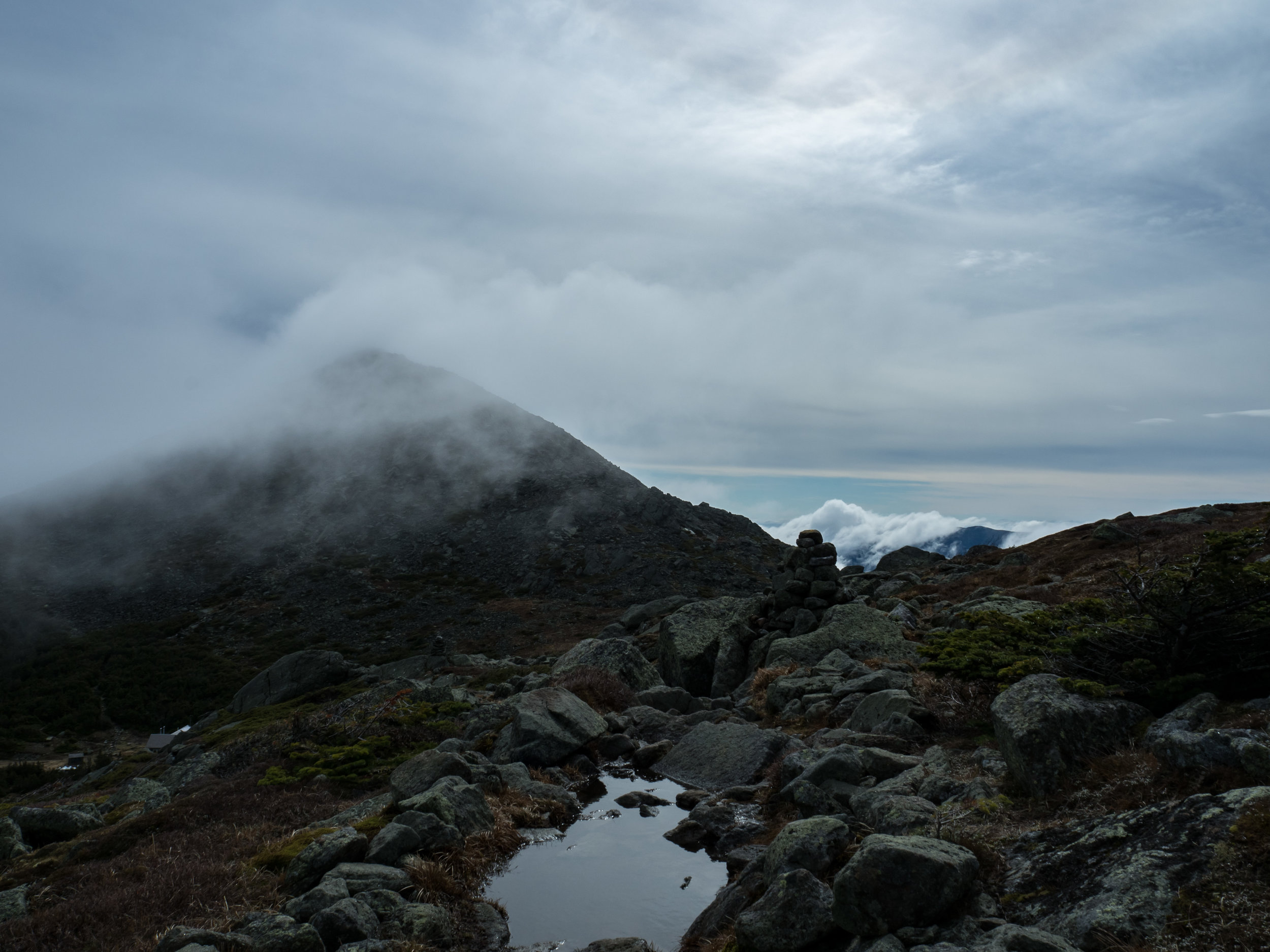
The summit was in full arctic mode, and with 40-50 mph winds, blowing snow, rime covered rocks, and very low visibility. That weather window, it never really opened. I did not hang out on the summit for long, and immediately enjoyed the moderate snow cover on the downhill with the Talons. With the metal dobs, you can just throw your foot anywhere and get traction, without the added weight of Microspikes. The mile off the summit drops 1200’, so there was some steep terrain in there that required intense concentration, creative footwork, and a prayer/expletive or two. The next two miles are flatter with several exposed sections, where tracks had been blasted off the mountain. I managed to navigate across a few of them, but the last one at about 3 miles was a bit of problem. I went left, right, left, right, back, forwards, around in a circle, and then thought about my chances of surviving an overnight bivy on the mountain with my wet clothing. The emergency plan would have been to head back up the mountain to the Burrows trail, or just head downhill through the woods until I reached Duxbury road. That could have been entertaining.
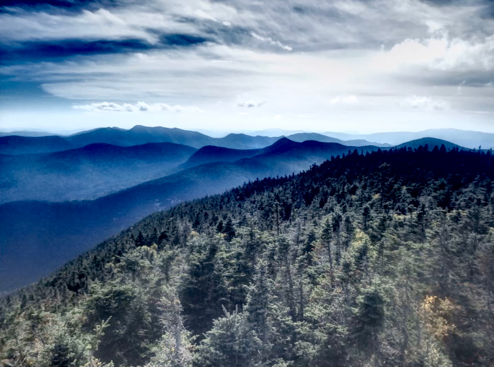
I was tremendously relieved to finally find the trail, and blasted back down into the woods like a kid entering Toys R Us. At times I was running blind after getting a snowy bough right in the face. My pace increased as the snow cover thinned and the grade decreased. I tried to avoid the puddles of slush, but there wasn’t room to get around some of them, which was…invigorating. I was looking forward to getting out of the snow and rain and into a warm car. I reached the trailhead at 2:54:50, but I wasn’t sure what the FKT was since I had been planning on the Monroe Skyline. The FKT for the complete trip on Bamforth Ridge was 3 hours even by Ethan Linck in 2013, so I was able to take a few minutes off. I’m looking forward to checking out the trail in less intense conditions, and the route met and surpassed my expectations from reading about it.

While it was nice to be able to run hard for a few hours and not carry anything, it would have been a good idea to bring my phone and maybe some extra gloves. Not sure how Steph would have reacted if I had called to ask for directions from the side of the mountain though. If you think you are off the trail, you probably are, so turn around and head back until you know you are on the trail. It’s probably a good thing I’m married with a family for these types of runs, as I wonder what kind of trouble I’d get myself into if I had no family obligations! Steph thought I was crazy to drive all that way for a run, but it certainly could have been more intense on the higher and more exposed Monroe Skyline. It can be fun to challenge the conditions on trail runs, as long as there is a healthy degree of respect for the weather, the terrain, and your own abilities.